Documented material — traceable
Thermal and high-resolution imaging of assets that would otherwise require scaffolding, a crane or rope access. Findings are documented with location data for maintenance and specialist use.
Services
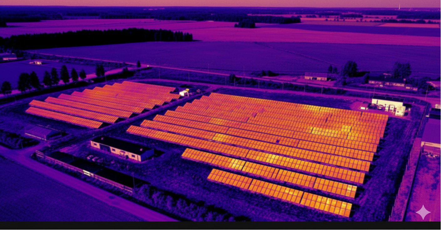
Full-array thermal imaging following the IEC TS 62446-3 procedure. Temperature anomalies are marked at module level and located by coordinates, so remedial work can be directed without a separate search.
Blade imaging without cranes or rope access. Findings are recorded with position on the blade and distance from the root. Full-resolution material is handed over for maintenance assessment.
Full external wall and roof thermal imaging without roof access. Temperature differences are documented as image pairs, so dirt, shadow and reflection can be distinguished from a genuine anomaly.
Imaging of lines, connections, insulators and structures from the air. Temperature anomalies and visible damage are recorded with location data for maintenance use, without de-energising the line.
Masts, bridges, roof surfaces and large areas. Data acquisition is carried out on assets where access would otherwise require scaffolding, a crane or rope access. Suitability is assessed before a quote is issued.
Comparison
The same information on asset condition without lifting anyone onto the structure. A survey flight takes hours where erecting and dismantling scaffolding takes days.
Nobody is lifted onto the structure. Fall risk, scaffold erection and dismantling, crane hire and work-at-height planning are eliminated. No load and no traffic damage on roof surfaces.
Imaging is carried out while the asset remains in service. Solar production is not interrupted, the line is not de-energised and the area does not need to be cordoned off. No downtime is incurred.
The client does not need to be on site. Location, access instructions and a contact person are sufficient to carry out the assignment. Material and report are delivered electronically afterwards — no client time spent on travel or waiting.
Other drone services
A dimensionally accurate aerial map of the site, from which distances and areas can be read directly. Applications include site planning, construction progress documentation, area verification and an overview of the site ahead of an investment decision.
A three-dimensional model or point cloud of a building, structure or area produced by photogrammetry. Suitable as design baseline data, for quantity take-off and for documenting the current state of an asset before modification work.
Property owners and housing companies
The same equipment and the same procedure at a smaller scale. The material is handed over for use by an installer, contractor or property manager.
Roof-mounted panels are imaged from the air without roof access. Temperature anomalies are marked panel by panel. An anomaly is grounds for follow-up, which is carried out by a solar electrician by measurement.
Thermal imaging provides the baseline for an energy renovation. The external walls and roof are imaged from the air and temperature differences documented as image pairs. The contractor or energy specialist can see where measures should be directed.
Operating principle
The material is produced by an independent operator. The conclusions are drawn by a specialist. The separation is deliberate — it keeps the finding free of commercial interest.
AeroInspect sells no panels, no installations and no repairs, and accepts no referral fees from recommended providers. A finding is not a sales argument. An independence clause is recorded on the first page of every report.
Every survey records the conditions: irradiance, outdoor and indoor temperature, wind speed, cloud cover, time of day, emissivity and reflected temperature. Warranty and insurance handling require this information.
Fault diagnoses and repair recommendations belong to the electrician, the maintenance partner or an inspector. The operator is responsible for the quality, coverage and traceability of the material.
Company
A Vaasa-based drone operator producing thermal and visual material on assets in the energy sector, industry and property management. Services cover thermal imaging and inspection imaging, mapping and orthophotos, 3D modelling and other drone imaging work. An assignment is handled end to end by the same provider: flight planning, permits, imaging and data processing, with no subcontracting chain.
The equipment in use is the latest available in the field. In thermal imaging it records a temperature value in every pixel. This distinguishes the material from a conventional thermally tinted image and is a precondition for a finding to hold up in warranty or insurance handling.
Qualifications & Equipment
Contact
Asset size, location and objective are sufficient for a quote. Quotes are valid for 30 days.